
Barron River Delta Investigation
The report of the Barron River Delta Investigation Steering Committee 1981. Copy available to read at the Cairns Historical Society.

Barron River Flood Map
Map showing the Barron River catchment and significant flooding events over time. The full map can be seen at Old Smithfield Cemetery - T. Parker
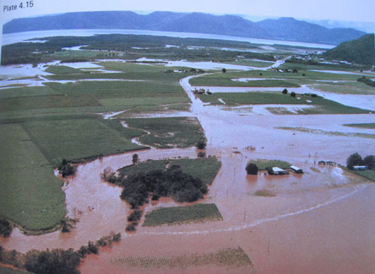
Barron River Flooding
Flooding in the Barron River delta in 1979. Six flood events were experienced in the Cairns region that year - Cairns.blog.net

Flood Marker
Flood marker showing expected maximum water height in the Barron delta - Cairns Regional Council

Freshwater Roundabout
Flooding at the roundabout in March 2012 - Cairns Regional Council

Golden Casket
Smiles outside the Golden Casket, Holloways Beach, corner of Oleander and Cara Streets, date unknown - Cairns Historical Society

Weekender
Special report of the Cairns Post dated 05-03-2007 with a focus on Holloways Beach - Cairns Historical Society

Deluge
Special report in the Cairns Post dated 06-03-2008 on flooding featuring the Freshwater Roundabout - Cairns Historical Society

The Northerner
The Northerner of 17-03-1967 showing flooding photos from Machans Beach - Cairns Historical Society

Inundation Flood
Map showing water inundation during the 1977 flood, appearing in the Barron River Delta investigation report 1981 - Cairns Historical Society

Pulling and Pushing a Car
People gather to help pull and push a car across a flooded Freshwater Creek in 1916 - Cairns Historical Society

SES at Machans Beach
SES volunteer Greg Uiduldam on watch at Machans Beach in March 2009 - S. Cooper

Machans Beach
Flooding at Machans Beach taken on 19 March 2012 - Cairns Regional Council